Enduring Indigenous Homelands Project (EIHP; 2021-)

OC Parks OCAC Repository work in 2022.
|
Conducted in collaboration with the Pechanga Band of Luiseno Indians (Payómkawichum) and Tongva (Ti’at Society), the EIHP is a community-based participatory research program (CBPR) that utilizes interdisciplinary methods
from archaeology, the digital humanities, and land conservation to examine the history of Indigenous anticolonial resistance and revitalization movements (1770−1870 CE) in California while preserving Indigenous sites. The EIHP was developed to support a core desire of Payómkawichum and Tongva tribes: mapping at-risk heritage sites in their shared homelands in Orange County (OC) and providing training in CBRP-based cultural heritage management. The EIHP is as a digital heritage research program that utilizes archaeological and anthropological methodologies to identify, map, and curate place-based Indigenous histories and social networks in Santa Ana and Santa Margarita Mountains of California. EIHP Indigenous-driven agenda is relevant to specific OC stakeholder communities and the public for the following reasons. First, public education programs and exhibitions of Indigenous culture are limited within OC’s mountainous wilderness parks. Southern California’s museums, archives, and land management agencies possess inventories of Indigenous cultural resources for urban regions due to contributions from cultural resource management work, but generally lack equal coverage for rural or wilderness areas. The uneven documentation and representation of Indigenous heritage reinforces an invisibility of first peoples, and potentially exposes the cultural resources stewarded by Orange County to land development. To address theses issues, the EIHP is focused on the following objectives:
The EIHP emerged from Nathan Acebo’s prior collaborative partnership with Tongva, Acjachemen (Juaneño-Acjachemen Culture Center) and Payómkawichum (Pechanga Band of Luiseno Mission Indians) peoples of southern California, and Orange County Parks, and The Wildlands Conservancy. |


Black Star Canyon Archaeology Project (BSCAP; 2013-2021)
|
The BSCAP examined the endurance and political effects of Indigenous traditions in the Los Angeles Basin colonial hinterlands, and the harmful effects of anti-Indigenous heritage tourism at the California Historical Landmark (#217) Puhú village in the Santa Ana Mountains of Orange County, California. The Puhú village landmark memorializes the 1832 “Battle of Black Star Canyon”, which was authorized by San Gabriel missionaries as a reprisal for alleged horse theft by Puhú’s residents and resulted in a massacre at the village by hired American frontiersmen. The BSCAP sought to understand Puhú’s ancestor residential life, the village communities ties to Indigenous political and trading networks before and after the massacre, and the colonists’ motivations for the reprisal. To achieve this, the BSCAP employed an interdisciplinary approach which merged artifact analyses of orphaned museum collections with geochemical archaeometry techniques (i.e. X-ray fluorescence and neutron activation analysis) with data from missionary records, ethnographic archives, and collaboration with and capacity building activities for Tongva, Acjachemen and Payómkawichum stakeholders.
Publications on the BSCAP can be found at the link below. In short, the BSCAP established that Puhú ancestors drew upon and enhanced pre- and post-contact traditions of craft production and trade, and how said practices allowed the village to economically thrive and remain politically autonomous while protecting Indigenous fugitives during Spanish and Mexican colonization. These findings challenge conventional scholarship that presumed post-contact California indigenous villages collapsed as native peoples were missionized or succumbed to European diseases by highlighting how the potential for macropolitical resistance emerges from micropolitical forms of Indigenous resiliency. Findings from ethnographic research revealed how 20th century curation practices and on-going heritage tours hid this history while reproducing false tropes of Indigenous extinction and hauntings. This research was enabled by funding support from the National Science Foundation, the Pacific Coast Archaeological Society, the Society for California Archaeology, Stanford University Institute for Research in the Social Sciences and research partnerships with the Cleveland National Forest, The Wildlands Conservancy, museum institutions (i.e. Gene Autry Southwest Museum and the San Bernardino County Museum), and the University of Missouri Research Reactor (MURR). |
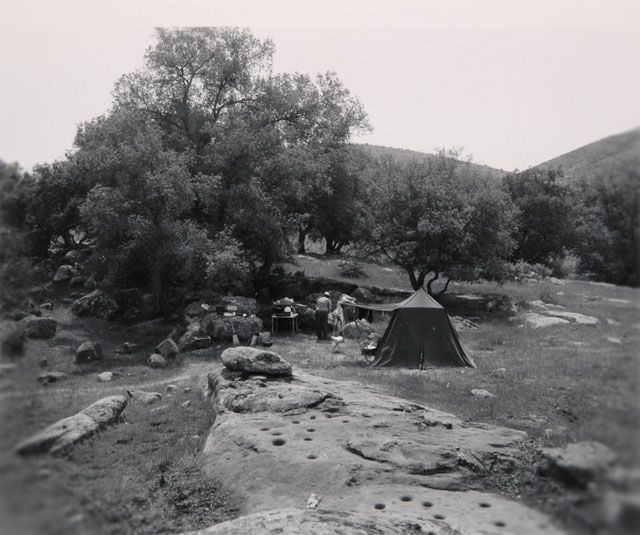
Archaeological Survey Association Excavations at Puhu in the 1950s.
|
In Development- Indigenous Archaeology in Oʻahu: Kānaka Maoli and Filipinx Bonds Through and Beyond the Plantations
|
Since 2019, Dr. Acebo has been developing a new project that examines the archaeology of early 20th century Kānaka Maoli, Filipinx and other Asian settler colonial sugar plantation laborers in Oʻahu, Hawaiʻi. The original envisioned project sought to explore Lāʻie Sugar Plantation (1868-1930 CE) as case study of how transnational colonial labor policies and informal plantation economies fostered cultural bonds between colonized transnational settlers and Kānaka Maoli peoples. After Covid-19 delay of in-person field research Dr. Acebo returned to Oʻahu-and Ko'olauloa specifically-to cultivate community partnerships with descendants, BYU Hawaiʻi, and the Filipino American National Historical Society in a effort to collaboratively explore the material history of Lāʻie through archaeological remains and oral histories of the plantation.
Research on Lāʻie is continuing, however the 2022 field season led to an array of new relationships and potential projects with/for Kānaka and Filipinx communities, wahi kūpuna and plantation labor movement stories on Oʻahu and Hawaiʻi (the Big Island). In addition to Ko'olauloa focused research, Dr. Acebo seeks to develop transnational Indigenous field school exchange program linking Indigenous and non-Indigenous students in Hawaiʻi, California and New England. |
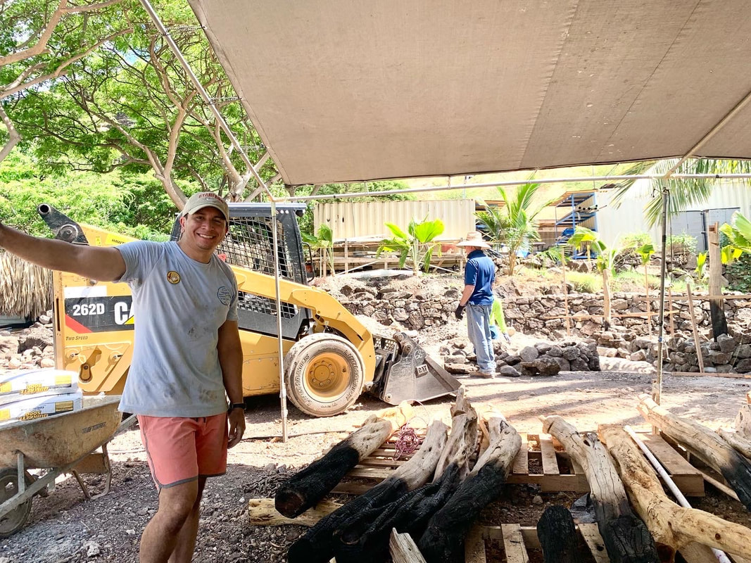
Hale construction (2022).
|